![](/images/other/stat-length.png)
![Tocht Fiets Le Thor - Circuit Vélo - Balade sur les rives de la Sorgue - Le Thor - Photo](https://media.geolcdn.com/t/1900/400/ext.pjpeg?maxdim=2&url=https%3A%2F%2Fservices.sitytrail.com%2FGeolivesWS%2FDownloadMedia.ashx%3FTrailID%3D118768%26Media%3D12965_5.jpg)
Circuit Vélo - Balade sur les rives de la Sorgue - Le Thor
tracegps
Gebruiker
![Lengte](/images/other/stat-length.png)
![Max. hoogte](https://static1.geolcdn.com/siteimages/upload/files/1508320355ic_sort_altitude_max_24dp.png)
![Positief hoogteverschil](https://static1.geolcdn.com/siteimages/upload/files/1508320355ic_sort_den_pos_24dp.png)
![Km-Effort](/images/other/stat-length.png)
![Min. hoogte](https://static1.geolcdn.com/siteimages/upload/files/1508320355ic_sort_altitude_min_24dp.png)
![Negatief hoogteverschil](https://static1.geolcdn.com/siteimages/upload/files/1508320355ic_sort_den_neg_24dp.png)
![Boucle](https://static1.geolcdn.com/siteimages/upload/files/16400158638029165_repeat_loop_refresh_sync_direction_icon.png)
![Fiets](https://static1.geolcdn.com/sitytour/trail-icons/200.png)
2h15
Moeilijkheid : Medium
![Scan deze QR-code om de tocht te openen in de SityTrail-applicatie](https://capi.geolives.com/qq0zvz2zws4bq2lad0pu/sitytour/trails/118768/qr.png?size=200)
Gratisgps-wandelapplicatie
Over ons
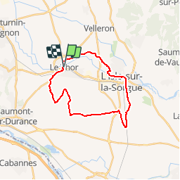
Tocht Fiets van 24 km beschikbaar op Provence-Alpes-Côte d'Azur, Vaucluse, Le Thor. Deze tocht wordt voorgesteld door tracegps.
Beschrijving
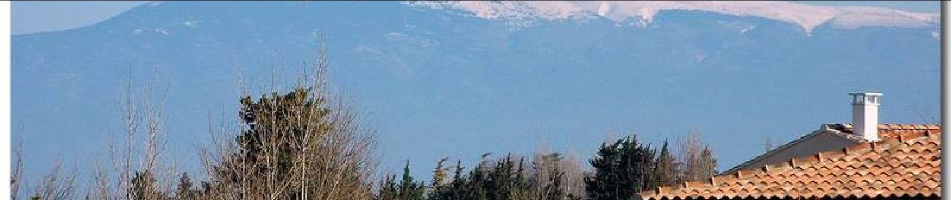
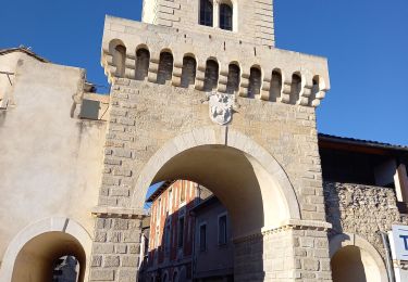
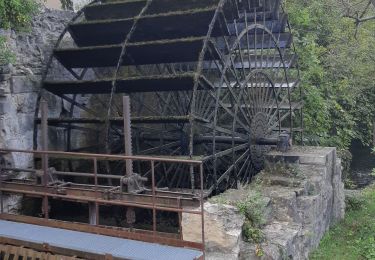
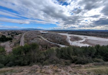
Depuis le village du Thor, ce circuit bien ombragé vous entraînera à travers la campagne jusqu’à L’Isle sur La Sorgue, à la découverte des vergers et champs cultivés, vaste réseau de canaux d’irrigation qui font de cette plaine des Sorgues un véritable Jardin. Départ de la Poste de Thor Retrouvez plus d’informations et téléchargez la fiche du circuit sur le site de la Provence en vélo.
Plaatsbepaling
Opmerkingen
Wandeltochten in de omgeving
![Tocht Hybride fiets Le Thor - Autour de la Sorgues - Photo](https://media.geolcdn.com/t/375/260/00a2aad6-7f0c-4fb7-a38d-e9113690acce.jpg&format=jpg&maxdim=2)
![Hybride fiets Hybride fiets](https://static1.geolcdn.com/sitytour/trail-icons/203.png)
Hybride fiets
![](/images/other/stat-length.png)
![](https://static1.geolcdn.com/siteimages/upload/files/16400158638029165_repeat_loop_refresh_sync_direction_icon.png)
![Tocht Stappen Velleron - les Arrayes pernes les fontzine - Photo](https://media.geolcdn.com/t/375/260/3cbf6432-1ded-4b5f-8c46-f9282d408bcb.jpg&format=jpg&maxdim=2)
![Stappen Stappen](https://static1.geolcdn.com/sitytour/trail-icons/101.png)
Stappen
![](/images/other/stat-length.png)
![](https://static1.geolcdn.com/siteimages/upload/files/16400158638029165_repeat_loop_refresh_sync_direction_icon.png)
![Tocht Stappen Le Thor - Autour de Thor château de Thouzon - Photo](https://media.geolcdn.com/t/375/260/75525555-cf65-4cb8-890a-434d58a7d426.jpg&format=jpg&maxdim=2)
![Stappen Stappen](https://static1.geolcdn.com/sitytour/trail-icons/101.png)
Stappen
![](/images/other/stat-length.png)
![](https://static1.geolcdn.com/siteimages/upload/files/16400158638029165_repeat_loop_refresh_sync_direction_icon.png)
![Tocht Stappen Le Thor - LE THOR - THOUZON - Photo](https://media.geolcdn.com/t/375/260/ea78f151-90aa-40e5-9a1b-69fcb96d9be6.jpg&format=jpg&maxdim=2)
![Stappen Stappen](https://static1.geolcdn.com/sitytour/trail-icons/101.png)
Stappen
![](/images/other/stat-length.png)
![](https://static1.geolcdn.com/siteimages/upload/files/16400158638029165_repeat_loop_refresh_sync_direction_icon.png)
![Tocht Stappen Le Thor - Autour de Thouzon - Photo](https://media.geolcdn.com/t/375/260/ext.jpg?maxdim=2&url=https%3A%2F%2Fservices.sitytrail.com%2FGeolivesWS%2FDownloadMedia.ashx%3FTrailID%3D895165%26Media%3Dfix__20180128155340.jpg)
![Stappen Stappen](https://static1.geolcdn.com/sitytour/trail-icons/101.png)
Stappen
![](/images/other/stat-length.png)
![](https://static1.geolcdn.com/siteimages/upload/files/16400158638029165_repeat_loop_refresh_sync_direction_icon.png)
![Tocht Stappen Velleron - Veleron (2) Pont des Arrayies - Photo](https://media.geolcdn.com/t/375/260/ext.jpg?maxdim=2&url=https%3A%2F%2Fservices.sitytrail.com%2FGeolivesWS%2FDownloadMedia.ashx%3FTrailID%3D376037%26Media%3D20141209150313.jpg)
![Stappen Stappen](https://static1.geolcdn.com/sitytour/trail-icons/101.png)
Stappen
![](/images/other/stat-length.png)
![](https://static1.geolcdn.com/siteimages/upload/files/16400158638029165_repeat_loop_refresh_sync_direction_icon.png)
![Tocht Stappen Velleron - Velleron Croix de Piegros - Photo](https://media.geolcdn.com/t/375/260/ext.jpg?maxdim=2&url=https%3A%2F%2Fstatic1.geolcdn.com%2Fsiteimages%2Fupload%2Ffiles%2F1553511878bg_sport_marche.png)
![Stappen Stappen](https://static1.geolcdn.com/sitytour/trail-icons/101.png)
Stappen
![](/images/other/stat-length.png)
![](https://static1.geolcdn.com/siteimages/upload/files/16400158638029165_repeat_loop_refresh_sync_direction_icon.png)
![Tocht Stappen Caumont-sur-Durance - Les Hauteurs de Caumont - Photo](https://media.geolcdn.com/t/375/260/2a1bd239-2607-4202-a026-2c2affd8ae94.jpg&format=jpg&maxdim=2)
![Stappen Stappen](https://static1.geolcdn.com/sitytour/trail-icons/101.png)
Stappen
![](/images/other/stat-length.png)
![](https://static1.geolcdn.com/siteimages/upload/files/16400158638029165_repeat_loop_refresh_sync_direction_icon.png)
![Tocht Stappen Velleron - velleron 1 - Photo](https://media.geolcdn.com/t/375/260/8c15d755-9b6d-4e00-90a5-84d81ca26c17.jpg&format=jpg&maxdim=2)
![Stappen Stappen](https://static1.geolcdn.com/sitytour/trail-icons/101.png)
Stappen
![](/images/other/stat-length.png)
![](https://static1.geolcdn.com/siteimages/upload/files/16400158638029165_repeat_loop_refresh_sync_direction_icon.png)
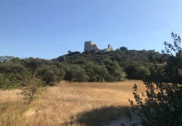
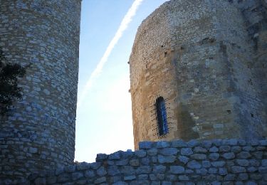
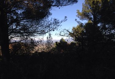
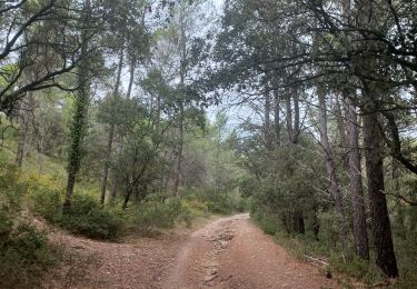
Mooie route met veel schaduw